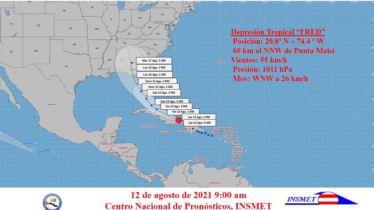
Tropical Cyclone Warning. Forecast Center, INSMET. Date: August 12, 2021. Time: 9:00 am.
Taken from the Institute of Meteorology of Cuba
TROPICAL CYCLONE NOTICE No. 7.
TROPICAL DEPRESSION FRED.
? Fred moves along the north coast of the eastern region?
During the last hours the tropical depression Fred has continued with little change in organization and intensity, it is maintained with maximum sustained winds of 55 kilometers per hour, with higher gusts and a minimum pressure of 1011 hectoPascal. Its movement continues towards the near west northwest, at a rate of 26 kilometers per hour.
At nine o’clock in the morning, Fred’s central region was estimated at 20.8 degrees North latitude and 74.4 degrees West longitude, a position that places it in Atlantic waters 60 kilometers north-northwest of Punta de Maisí, the eastern end of Cuba and about 130 kilometers east of Punta Lucrecia, Holguín province.
In the next 12 to 24 hours Fred will continue on a similar course, slowing his translation speed, to move today through the seas adjacent to the north coast of the eastern provinces and tomorrow along the north coast of the center of the country. Little change in intensity is forecast today, with the possibility of gaining intensity again this Friday.
With the predicted movement of the tropical depression Fred, there will be a gradual increase in clouds and rains in the eastern region of Cuba from this morning, with showers, rains at intervals and thunderstorms, which can become strong and intense in some localities from the afternoon, mainly mountainous. Somewhat strong winds can also occur in gusts with speeds between 40 and 60 kilometers per hour during thunderstorms, even in areas far from the center of circulation. There will be swells on the north eastern coast, with accumulations of water in low areas of this coast.
The next tropical cyclone advisory on this system will be issued at noon today.

