
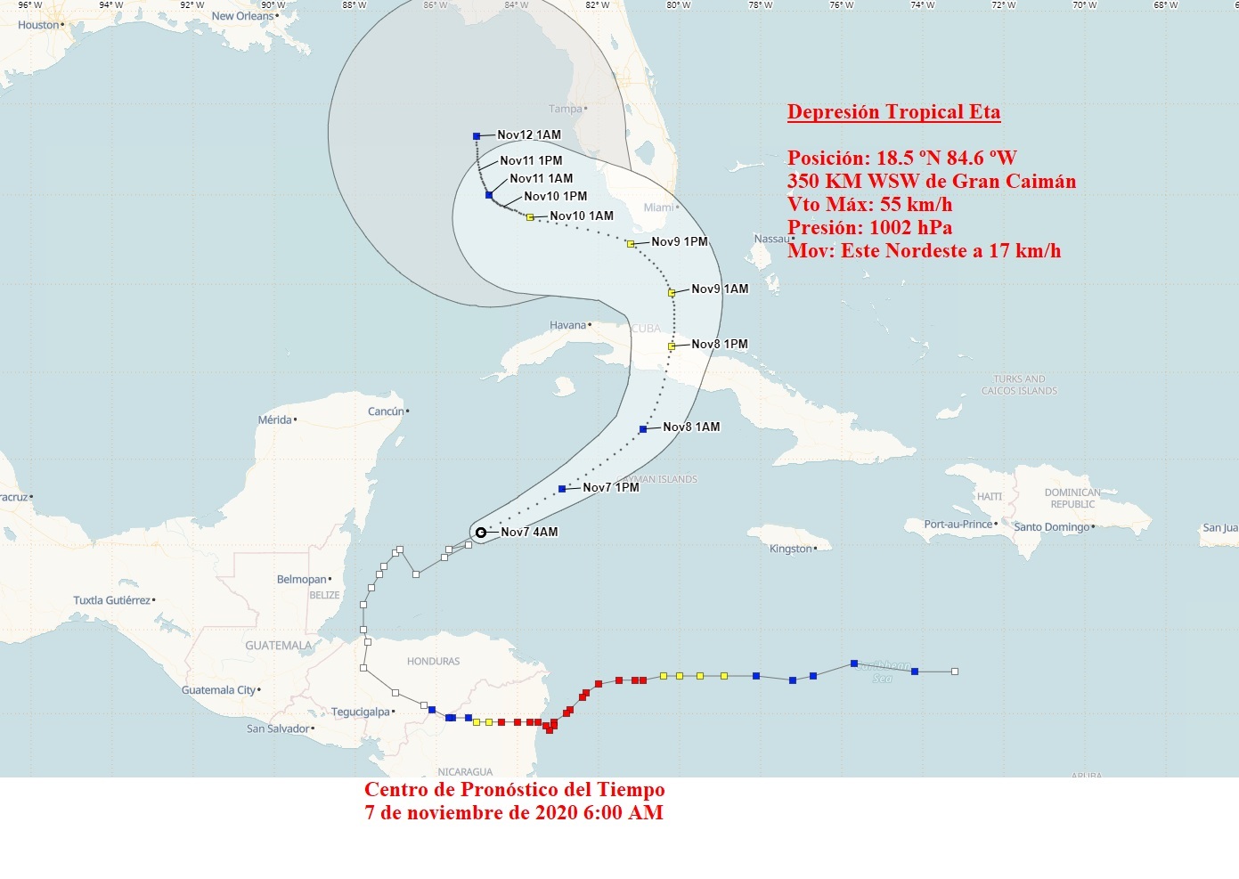
During the early morning the tropical depression Eta, has tilted its course to the east northeast and its speed of translation is 17 kilometers per hour, entering the waters of the western Caribbean, showing signs of organization, but without change in intensity. It maintains maximum sustained winds of 55 kilometers per hour, with higher gusts and a central pressure of 1002 hectoPascal, according to the Institute of Meteorology.
At six o’clock this morning, its central region was estimated at 18.5 degrees North latitude and 84.6 degrees West longitude, 348 kilometers west southwest of Cayman Grande.
In the next 12 to 24 hours, Eta will continue heading close to the northeast, increasing its speed of translation further. This depression transits over warm waters, which will allow it to gain in organization and intensity, and this morning it could turn into a tropical storm.
With this course and speed of translation, Eta will approach the seas to the south of Cuba on Saturday night, increasing the rains in much of the archipelago, which can be strong and intense, even in areas far from the center.
From Saturday night, winds with tropical storm force could be registered, mainly in the central region. These winds will produce strong swells on the southern coast with light to moderate coastal flooding on the southern coast of the eastern half of the country. The areas affected by these dangers and their magnitude will be in relation to the evolution and future trajectory of Eta.
The next tropical cyclone advisory on this organism will be issued at noon today.