
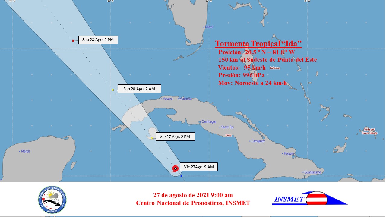
During the late and early morning, Tropical Storm Ida has continued to gain in organization and intensity. Now it has maximum sustained winds of 95 kilometers per hour, with higher gusts and with a central pressure that has dropped to 996 hectoPascal.
The rainy areas have continued to affect the central and eastern regions, which have become strong in the south of these territories. The weather station of Cabo Cruz, Granma reported a total of 129 millimeters until 8 am today.
At nine in the morning its central region was estimated at 20.5 degrees North latitude and 81.8 degrees West longitude, a position that places it about 150 kilometers southeast of Punta del Este, Isla de la Juventud. Its movement continues with a course near the northwest, with a translation speed of 24 kilometers per hour.
Ida is forecast to continue on a similar course and with little change in her speed of translation, gaining somewhat more in organization and intensity, approaching the Isle of Youth at the end of the morning.
The rainy areas will continue to affect the south eastern and central portion, extending to the Isle of Youth and the rest of western Cuba from noon, which will be strong and intense in some locations.
The winds will reach tropical storm force in Isla de la Juventud and the Canarreos archipelago, from the end of the morning, with speeds between 70 and 95 kilometers per hour, with gusts that can reach hurricane force.
As the center of Ida approaches the west, tropical storm-force winds will spread to the provinces of Pinar del Río, Artemisa, Havana and Mayabeque. These winds can reach speeds of up to 100 kilometers per hour, with higher gusts in areas of showers and storms.
There will be strong swells on the southern coast of Isla de la Juventud and the Canarreos archipelago, with danger to navigation and moderate coastal flooding. On the southern coast of the provinces from Pinar del Río to Cienfuegos there will be swells, with moderate coastal flooding in low areas of the provinces from Pinar del Río to Mayabeque.
The next tropical cyclone advisory on this system will be issued at noon on Friday.